

Most construction project issues don’t begin with execution errors. They start with assumptions made early in the process, especially when site data is incomplete or inaccurate. Even small discrepancies can create budget overruns, timeline delays, and coordination challenges as projects move further away from real site conditions. That’s why reliable data at the starting point matters.
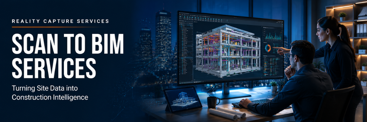
RPG Squarefoot Solutions supports construction companies with advanced reality capture and 3D laser scanning services that eliminate guesswork by delivering precise, measurable site data. Through Scan to BIM, physical spaces are captured using technologies like Leica BLK360 and Leica RTC360, converted into detailed point clouds, and transformed into BIM models that accurately reflect on-site conditions for architects, engineers, and contractors. This process also improves existing condition documentation, giving teams a more reliable foundation for planning, coordination, and execution.
In this post, let’s explore how Scan to BIM services work, the challenges caused by inaccurate site data, and where these solutions are used across construction projects.
Workflow: How Scan to BIM Services Work
The Scan to BIM workflow is straightforward, but every step plays an important role in accuracy and output quality.
- Step 1: Scanning:
The process begins with 3D laser scanning using tools like the Leica BLK360 or Leica RTC360. The site is captured in detail to record actual conditions.
- Step 2: Processing:
Once scanning is complete, the captured data is cleaned, organized, and structured into a usable point cloud. This step transforms raw site information into a reliable digital foundation for BIM modeling.
- Step 3: Modeling:
The point cloud is then converted into a BIM model through scan to BIM services, creating an accurate digital representation of the site.
- Final output usage:
Once the model is ready, teams can confidently begin design, coordination, and analysis using verified site conditions as the base reference.
Challenges: What Happens Without Scan to BIM
Many projects still rely on older drawings or partial surveys, which often creates problems during design and construction. Here are some common challenges teams face without accurate reality-capture data.
- Design conflicts during construction: Design conflicts often appear only after execution begins, creating unexpected on-site issues.
- MEP clashes with structure: Mechanical, electrical, and plumbing lines often clash with structural elements, leading to redesign or adjustments.
- Mismatch in layouts: Walls and built elements do not always match the planned drawings, causing alignment and fitment issues.
- Rework impact: Unverified site conditions frequently lead to rework, increasing project costs and reducing overall execution efficiency.
- Project delays: Late-stage discovery of site issues can disrupt multiple trades simultaneously, affecting schedules and slowing overall project progress.
- Hidden cost accumulation: Small measurement inaccuracies can gradually compound into larger budget overruns and timeline extensions over the course of the project.
Benefits of Scan to BIM services
Here are some key benefits of Scan to BIM services.
- Accurate modeling: The BIM model reflects actual site conditions instead of rough estimates.
- Faster planning: Teams spend less time double-checking measurements and more time making decisions that move the project forward.
- Improved coordination: MEP, structural, and architectural teams work from the same verified site conditions, helping reduce field conflicts, coordination issues, and unnecessary redesign work.
- Fewer construction surprises: Accurate site data helps identify potential issues earlier, reducing unexpected problems during construction activities.
Where Scan to BIM Actually Helps
Scan to BIM isn’t limited to one type of project. It shows its value across different segments as follows.
- Renovation projects: Older buildings often lack updated or reliable documentation. 3D scanning removes guesswork before design and planning begin.
- MEP coordination projects: Congested service areas require precise spatial coordination. Scan to BIM helps identify clashes early and improve planning.
- Infrastructure projects: Complex environments such as stations, industrial plants, and large campuses require highly accurate site data before any work starts.
Reduce Errors and Get Actionable Construction Intelligence
Scan to BIM services help construction teams reduce uncertainty, improve coordination, and make decisions based on verified site conditions instead of assumptions. For renovation, infrastructure, and coordination-intensive projects, accurate digital site data can help teams avoid costly rework, reduce delays, and improve planning confidence. Explore Scan to BIM services offered by RPG Squarefoot Solutions and see how better site intelligence can support more efficient project execution.
Frequently Asked Questions
- What is Scan to BIM?
Scan to BIM is the process of converting 3D laser scan data and point clouds into accurate BIM models that reflect actual site conditions for planning, coordination, and construction workflows. - How does Scan to BIM reduce construction rework?
By providing accurate existing condition documentation, Scan to BIM helps teams identify clashes, layout conflicts, and design issues before construction begins, reducing costly field changes and delays. - Can Scan to BIM integrate with BIM workflows?
Yes. Scan to BIM services integrate directly into BIM coordination workflows, supporting clash detection, design validation, renovation planning, and construction analysis.
Blog Latest Posts
Most construction project issues don’t begin with execution errors. They start with assumptions made early in the process, especially when site data is incomplete or inaccurate. Even small discrepancies can create budget overruns, timeline delays, and coordination challenges as projects move further away from real site conditions. That’s why reliable data at the starting point matters.
RPG Squarefoot Solutions supports construction companies with advanced reality capture and 3D laser scanning services that eliminate guesswork by delivering precise, measurable site data. Through Scan to BIM, physical spaces are captured using technologies like Leica BLK360 and Leica RTC360, converted into detailed point clouds, and transformed into BIM models that accurately reflect on-site conditions for architects, engineers, and contractors. This process also improves existing condition documentation, giving teams a more reliable foundation for planning, coordination, and execution.
In this post, let’s explore how Scan to BIM services work, the challenges caused by inaccurate site data, and where these solutions are used across construction projects.
Workflow: How Scan to BIM Services Work
The Scan to BIM workflow is straightforward, but every step plays an important role in accuracy and output quality.
- Step 1: Scanning:
The process begins with 3D laser scanning using tools like the Leica BLK360 or Leica RTC360. The site is captured in detail to record actual conditions.
- Step 2: Processing:
Once scanning is complete, the captured data is cleaned, organized, and structured into a usable point cloud. This step transforms raw site information into a reliable digital foundation for BIM modeling.
- Step 3: Modeling:
The point cloud is then converted into a BIM model through scan to BIM services, creating an accurate digital representation of the site.
- Final output usage:
Once the model is ready, teams can confidently begin design, coordination, and analysis using verified site conditions as the base reference.
Challenges: What Happens Without Scan to BIM
Many projects still rely on older drawings or partial surveys, which often creates problems during design and construction. Here are some common challenges teams face without accurate reality-capture data.
- Design conflicts during construction: Design conflicts often appear only after execution begins, creating unexpected on-site issues.
- MEP clashes with structure: Mechanical, electrical, and plumbing lines often clash with structural elements, leading to redesign or adjustments.
- Mismatch in layouts: Walls and built elements do not always match the planned drawings, causing alignment and fitment issues.
- Rework impact: Unverified site conditions frequently lead to rework, increasing project costs and reducing overall execution efficiency.
- Project delays: Late-stage discovery of site issues can disrupt multiple trades simultaneously, affecting schedules and slowing overall project progress.
- Hidden cost accumulation: Small measurement inaccuracies can gradually compound into larger budget overruns and timeline extensions over the course of the project.
Benefits of Scan to BIM services
Here are some key benefits of Scan to BIM services.
- Accurate modeling: The BIM model reflects actual site conditions instead of rough estimates.
- Faster planning: Teams spend less time double-checking measurements and more time making decisions that move the project forward.
- Improved coordination: MEP, structural, and architectural teams work from the same verified site conditions, helping reduce field conflicts, coordination issues, and unnecessary redesign work.
- Fewer construction surprises: Accurate site data helps identify potential issues earlier, reducing unexpected problems during construction activities.
Where Scan to BIM Actually Helps
Scan to BIM isn’t limited to one type of project. It shows its value across different segments as follows.
- Renovation projects: Older buildings often lack updated or reliable documentation. 3D scanning removes guesswork before design and planning begin.
- MEP coordination projects: Congested service areas require precise spatial coordination. Scan to BIM helps identify clashes early and improve planning.
- Infrastructure projects: Complex environments such as stations, industrial plants, and large campuses require highly accurate site data before any work starts.
Reduce Errors and Get Actionable Construction Intelligence
Scan to BIM services help construction teams reduce uncertainty, improve coordination, and make decisions based on verified site conditions instead of assumptions. For renovation, infrastructure, and coordination-intensive projects, accurate digital site data can help teams avoid costly rework, reduce delays, and improve planning confidence. Explore Scan to BIM services offered by RPG Squarefoot Solutions and see how better site intelligence can support more efficient project execution.
Frequently Asked Questions
- What is Scan to BIM?
Scan to BIM is the process of converting 3D laser scan data and point clouds into accurate BIM models that reflect actual site conditions for planning, coordination, and construction workflows. - How does Scan to BIM reduce construction rework?
By providing accurate existing condition documentation, Scan to BIM helps teams identify clashes, layout conflicts, and design issues before construction begins, reducing costly field changes and delays. - Can Scan to BIM integrate with BIM workflows?
Yes. Scan to BIM services integrate directly into BIM coordination workflows, supporting clash detection, design validation, renovation planning, and construction analysis.