Surveying has long been a fundamental component in land development, construction, and engineering projects. Traditionally, surveyors rely on instruments such as total stations and GPS receivers to gather critical data. However, the introduction of 3D laser scanning technology has completely transformed the field, delivering notable advantages in speed, accuracy, safety, and the level of detail captured.
In this article, we’ll dive into the key differences between 3D laser scanning and traditional surveying techniques, and explore how this technology is shaping the future of surveying.
Speed and Efficiency
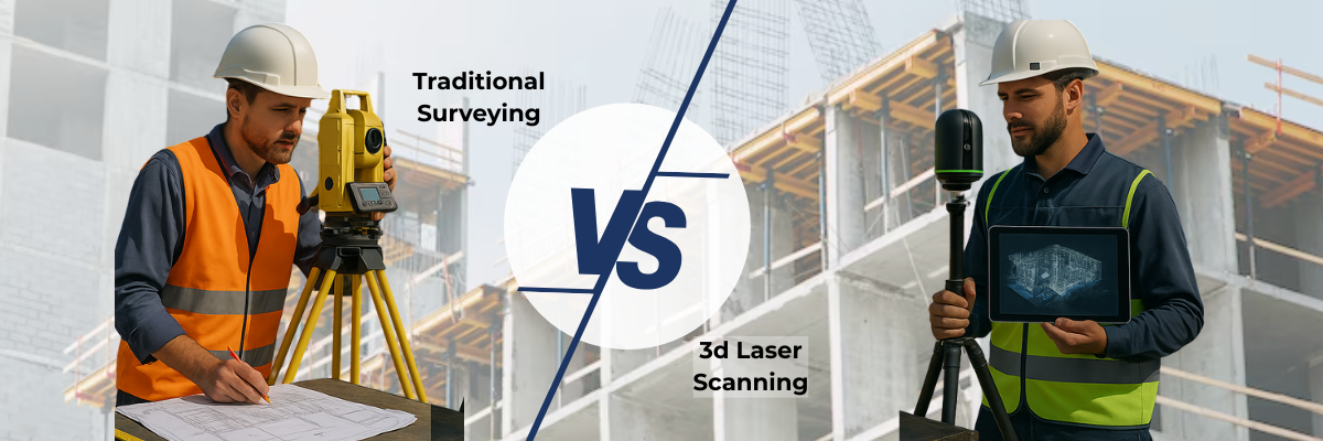
One of the most compelling benefits of 3D laser scanning over conventional surveying methods is the speed of data collection. A laser scanner can record thousands of points per second, enabling rapid coverage of large and complex areas.
In contrast, traditional surveying often involves labor-intensive, manual measurements that can be time-consuming and error-prone. A study by the American Society of Civil Engineers found that 3D laser scanning reduces data collection time by up to 50%compared to traditional methods.
Faster data collection not only accelerates project timelines but also reduces overall project costs, making it an increasingly attractive option for projects sensitive to both time and budget constraints.
Accuracy and Precision
Precision is paramount in surveying, and 3D laser scanning excels in this area. 3D laser scanners generate exceptionally accurate data sets, often at millimeter-level precision. What’s remarkable is the consistency of this accuracy, which remains unaffected by environmental conditions or challenging terrains.
Traditional methods, by comparison, can suffer from inaccuracies caused by manual instrument handling, calibration errors, or adverse weather conditions. With its automated and digital nature, 3D laser scanning minimizes human error, ensuring more reliable and precise survey results.
Comprehensive Data Capture and Scan to BIM
Beyond speed and accuracy, 3D laser scanning stands out for its ability to capture intricate site details. Traditional surveying tools may struggle to document complex geometries, especially in hard-to-reach areas or irregular terrains.
Laser scanning, however, captures dense point clouds that represent the full geometry of structures and landscapes in vivid detail. In one case study by a prominent engineering firm, a mhistorical building restoration revealed previously unnoticed architectural features when scanned with 3D technology—leading to a more faithful and accurate restoration plan.
Safety and Accessibility
Surveying often involves working in hazardous or inaccessible locations. Traditional surveying methods frequently require physical access to dangerous sites, exposing workers to risks such as unstable ground, steep slopes, or inclement weather.
With 3D laser scanning, surveyors can capture data remotely without having to physically access hazardous areas. This greatly enhances surveying safety protocols while also allowing access to previously unreachable or restricted environments.
Advanced Applications of 3D Laser Scanning
3D laser scanning capabilities extend far beyond basic surveying by enabling the creation of highly accurate 3D models from captured point clouds, providing invaluable resources for architects, engineers, and project managers.
Additionally, 3D scanning plays a critical role in:
- Forensic investigations and accident reconstruction, offering highly detailed recreations for legal proceedings.
- Cultural heritage preservation, allowing accurate documentation of historical landmarks, artifacts, and monuments to protect them for future generations.
Environmental Impact and Sustainability
In an age where sustainability is essential, 3D laser scanning offers an eco-friendly surveying option. By minimizing the need for physical site intrusion, laser scanning reduces environmental disruption, particularly in sensitive ecosystems and protected sites.
This aligns perfectly with broader initiatives across industries to promote sustainable practices and reduce the environmental impact of field operations.
Why Choose Leica 3D Laser Scanners?
When it comes to 3D laser scanning, not all equipment is created equal. Leica Geosystems is globally recognized for producing some of the most advanced, reliable, and precise 3D laser scanners on the market. Their cutting-edge technology delivers superior performance across a wide range of applications—from construction and civil engineering to historical preservation and forensic analysis.
At RPG Squarefoot Solutions, we proudly offer the full suite of Leica 3D laser scanning solutions, tailored to meet your project’s unique needs. Whether you require detailed building surveys, large-scale topographical mapping, or highly accurate BIM integration, we have the expertise and technology to help you succeed.
Contact RPG Squarefoot Solutions today to learn how we can equip you with the best tools and services for your next surveying project!
